Scafell & Slight Side from Eskdale

20 09 2013

When I got the phone call weeks ago from John requesting two days of Private Hire I was already over the moon, but when he requested that on one day we walk Pillar from Wasdale (as we did last week) and then said he wanted to climb Scafell from Eskdale, I almost jumped out of my chair! I even remember saying ‘Scafell?? Not Scafell Pike??’

Damas Dubs

We set off from Brotherikeld at about 9.45 and started making our way up the valley. The cloud was currently sitting on the tops, but the forecast was for it to clear through, with perhaps a few showers beforehand. The intended route, and possibly most commonly taken route is via Great Moss. To do this we would follow the River Esk on it’s right hand side and cross it below the Scafells. With all the rain we have had recently, and a river fording issue fresh in my mind from Sunday’s walk above Mungrisedale, we studied the map for an alternative, and we found a good one.  Instead of following the river we would take a higher route over Damas Dubs and then drop down to Cam Spout Crag below Scafell.

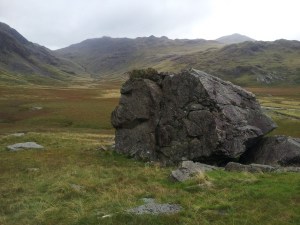
Upper Eskdale

We made great progress and Damas Dubs was very enjoyable. the map  implied it would be a bit of a bog fest but we only had to hop a few bogs. The showers did come and go as we walked along these few kilometers, but nothing major.

Sampson's Stones

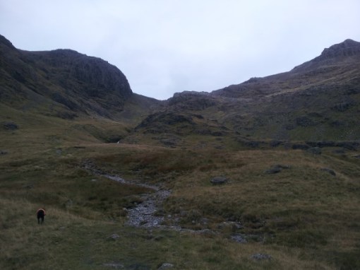
The impressive Cam Spout Crags came into view, and we stopped to soak it all up. The subsidiary summit of Pen was also clear, and now so was Esk Pike and Bowfell at the head of the valley. We made our way through the Sampson’s Stones, past Cam Spout Crag, to the waterfalls that would lead us up to the start of the Foxes Tarn route, our chosen path up onto Scafell.

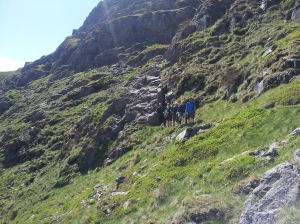
We scrambled up past the impressive waterfalls and when we got to the top of them we took the opportunity to have a bite to eat. We admired the Crinkle Crags and Bowfell sitting opposite us, as well as the vast boggy expanse of Great Moss sitting below. After lunch we continued upwards alongside a picturesque beck until we were standing underneath the first part of the path that led to Foxes Tarn.

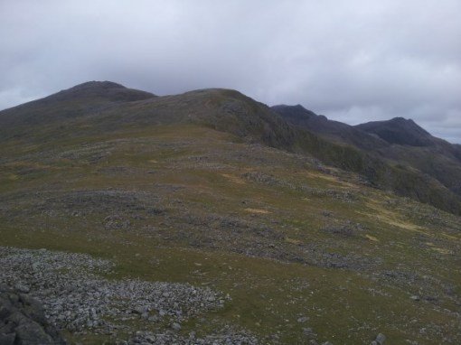
Looking towards Mickledore

This scramble is is always fun, and even more so today with the amount of water coming down. We quickly made up the ground and got to Foxes Tarn. All that was left from the tarn was a steep walk up onto the plateau, and then a short hop onto the summit of Scafell. Unfortunately just before we reached the plateau the cloud that had previously cleared all the summits decided to drop, and so our view from the summit was restricted to about 50 metres.

Slight Side from Scafell

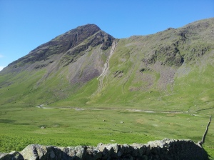
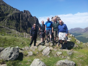
From the summit we headed South, South West along the ridge, at first picking our way over boulders, and then picking up a much easier path which soon turned to grass. We ambled on over the easy terrain to Slight Side, a rocky little top that sits on the southern slopes of Scafell. From Scafell Slight Side looks very ordinary, but looking up at it from the south gives it a very impressive, and imposing appearance!

We continued our descent over easy grassy terrain. This section was quite boggy so our feet got pretty damp! We cut off of the path by Cat Crag and got off of the fell via a bracken covered slope. A short walk brought us back to the car at Brotherikeld. Once back at the car the cloud had once again lifted completely and it was looking quite bright. We couldn’t help but stand for a while and admire the fine fells we had just walked, and the epic valley we used to get to them. What a trmendous part of the Lake District!!

Scafell and Ill Crag

A full album of pictures can be found on this link.


Patterdale to Ambleside via St Sunday’s Crag & Fairfield with Atrium Aviation

6 09 2013

Yesterday I once again have the joy of guiding a group from Atrium Aviation. Mark was once again hosting the group and his criteria was the same as last time – A linear walk of about 7 hours which finishes at a pub. We put our heads together and rattled off a few possible routes. Mark mentioned he personally hadn’t walked on the fells above Patterdale, and had never been on Fairfield so we decided to go for a route that would give the group that experience.

The forecast was for a cloudy morning which would soon break off to provide a clear and sunny afternoon. As we arrived in Patterdale at 9am the skies were blue and the sun was already blazing, it seemed the cloud had already disappeared! From the Patterdale Hotel we made our way out the back on a public footpath, and after just a short distance we were heading off the main path and up the fellside. Our first objective of the day was Arnison Crag, a great little viewpoint that has remarkable views over Ullswater. The climb to the summit is a steep grassy one so we took our time and stopped often to enjoy the views. We made excellent progress and after not much more than half an hour we were standing on top watching a military helicopter flying low over Ullswater.

After dishing out the sherbert lemons and taking some snaps we made our way over and around some bumpy terrain before once again making our way up a steep grassy ascent towards the summit of Birks. The heat of the day was building so we ensured we had regular stops to have a drink.

20130905_101045

From the flat summit of Briks we then walked across easier terrain before making the final ascent onto the summit of St Sunday’s Crag. Unfortunately the cloud had dropped and we were now in the mist, it seemed the cloud that we thought had dissipated was just late! 

We didn’t linger for long on the summit and we enjoyed a gentle descent to Deepdale Hause, from which we did get some breaks through the mist to see into the Deepdale Valley. We continued on through the mist on broken terrain as we headed for Cofa Pike. The  ridge narrowed and out of the mist came the rocky summit. 

Keen for lunch we soon moved on and a short walk up some shale brought us onto the vast flat summit of Fairfield. Unfortunately we were well and truly in the mist for the lunch stop. We stopped for just over 20 minutes but we started to get a bit chilly so we decided to crack on. As we made our way towards Hart Crag we started to get small glimpses through the cloud, then all of a sudden it opened up to provide us with amazing views in all directions.

We continued over Hart Crag to Dove Crag. We now followed the long wall over much easier terrain over High Pike and then onto Low Pike, our eighth  and final summit of the day. We made our way to the lovely High Sweden Bridge from which an easy amble along a good track brought us into Ambleside, and our pub of choice – The Golden Rule. 

In total we walked about 9 miles with 1100m of ascent and took about 7 and a half hours. I’m already looking forward to next years walk! For a full album of pictures please visit this link.


Seatoller to Langdale with Atrium Aviation

10 07 2013

A couple of months ago I was contacted by Mark Hiller of Atrium Aviation in order to assist on one of his annual walks. It was clear from the offset that Mark already had a high level of experience with the Lake District, and that he was searching for something particularly special for the first of this years walks. What was great about this group is that they wanted a linear walk that finished in a pub, fantastic!

Over the following months we ran through route options until we landed on the one that we completed yesterday, and what a mighty fine choice it was.

20130709_090633

I met the group of 9 outside the Keswick Hotel and we were then transported the short way down the Borrowdale Valley to Seatoller. The weather was continuing it’s fine form and even at 8am you could tell it was going to be a hot one!

We started through the vegetation as we made our way to the base of Thornythwaite Fell, the western arm like spur that comes off of Glaramara’s northern flanks. Everyone made good progress up this initial slope, and we stopped every so often to cool off in the small breeze that was blowing, a breeze that we were all so very thankful of.

20130709_102553

We walked and talked and soon enough we stood beneath the summit of Glaramara. The group took varying lines up the final scramble, and everyone seemed impressed with Lexi’s ability to get up some of the sections. 20130709_102829

We took a breather on the summit and soaked up the fine views. The heat was continuing to rise, and because of this it was quite hazy, but we would all take haze over driving rain!

With the hard bit of the day done we continued over the undulating plateau of Glaramara and made our way to the summit of Allen Crags, yet another fine view point. We took this opportunity to have some lunch.

Half an hour soon passed and we seemed to be getting too comfortable. Who could blame us?  Full tummies, amazing views and the sun beating down….just 5 more minutes?

We descended to Esk Hause which was to be our decision point. We had multiple options on how to finish the walk, one of which being making our way over to the Langdale Pikes. We opted to head over Esk Pike followed by Bowfell. The group continued to be efficient and we made great time to the summit of Bowfell, getting there at 2pm.

20130709_135145

We once again took a slightly longer stop, making sure we enjoyed the views from what I regard one of the best, if not the best, viewpoint in Lakeland. Sadly we were driven from the summit by the midges sooner than we would have liked, but the pub beckoned anyhow!

20130709_133919

From the summit we took a slight detour to admire The Great Slab and then we descended to the Three Tarns. We then joined the good track and made our way down The Band, soaking up the impressive views of the Langdale Pikes and the Langdale Valley all the way.

By half 3 we walked into the Old Dungeon Ghyll where we started a course of re-hydration!  A perfect day out!

20130709_152858


The Coledale Horseshoe

29 06 2013

As I have said in Blog Posts before, The Coledale Horseshoe is amazing! I love every opportunity I get to guide people on it and share with them my fave walk.

Me and Steve set off up the Kin Ridge towards Grisedale Pike. The weather was clearning by the minute, and unlike yesterday, we didn’t have to put the waterproofs on at the car. We took it easy up the initial steep grassy climb and then enjoyed the views back towards Keswick as we headed for the next steep bit. We continued to make good progress right to the windswept summit of Grisedale Pike. We didn’t linger on the top as it was a bit chilly, so we left straight away for Hopegill Head.

On the summit of Hopegill Head we met some marshalls who were involved with the Buttermere Fell Race. The route the fellrunners were completing sounded absolutely nuts! A short while after leaving the summit we saw our first load of runners.

We stopped just up from Coledale Hause for a leisurely bite to eat while watching the runners head up Grasmoor. After lunch we climbed easily to the summit of Eel Crag. We took a moment to sit on the edge of the summit enjoying the fine views down into the Coledale Valley.

20130629_125508

Our next summit was Sail, after which we descended all the way to the good track by Scale Force Mine. We finished the day with an easy plod along the track back to the car, perfick!

This slideshow requires JavaScript.


Skiddaw via Ullock Pike

23 06 2013

Today’s walk was meant to be Blencathra & Sharp Edge, but after seeing the forecast for the weekend on Friday, I knew that Sharp Edge would be treacherous. Our round of Helvellyn & it’s edges yesterday was a tad slippy, and reading the news report of a person who took a 100m lob off of Swirral Edge yesterday just goes to show how easily things can go wrong.

I took the decision to bin the Blencathra walk completely. It is a mountain that is best enjoyed via it’s edges, and if the edges wouldn’t be enjoyable, what’s the point? So Skiddaw it was!

We started from High Side, on the north western flank of the mountain. It was a misty morning and it was obvious from the start the wind was going to be brisk. We made great progress up the ridge towards Ullock Pike. We did enjoy some nice views down onto Bassenthwaite but they were short lived. As we climbed higher and higher the wind strength increased, but occasionally we would find the odd hollow to provide some shelter. We continued over Ullock Pike onto the summit of Long Side, essentially just a continuation of the same ridge.

From Long Side we descended and located the summit of Carl Side in the mist. Now we had the big one to summit, Skiddaw. We took the steep scree path that kinda’ contours it’s way onto the plateau. Everyone climbed well up this thigh burning track.

Up on the plateau a short walk brought us to the wind blasted summit, an all too common occurrence on Skiddaw.  We squatted in the shelter for a few minutes to have snack but soon after we were off. We left the summit to the north and located the fence. Navigationally this fence is amazing, as we just followed it all the way to the summit of Bakestall, and then downwards again to the good track.

We followed the farmers track back down the valley enjoying the views. A combination of us descending and the cloud lifting meant we finally got to see something. An enjoyable walk back down the track and a bit of road at the end brought us back to the cars.

This slideshow requires JavaScript.


Pillar from Wasdale via the High Level Route

19 06 2013

It is not often I get a request to take a group up Pillar, but when I did, I was over the moon! Pillar and the surrounding fells are a fantastic, classic walking experience, but one that so many people overlook for what stands on the other side of the valley – Scafell Pike.

I met George, David, Ian, Johnathon and John (Dudley) on the village green in Wasdale just before 9am. The weather was looking fantastic, a day where it would be a shame not to be on the fells!

At The Start

We set off behind the Wasdale Head heading for the Black Sail Pass. I learnt that Pillar via the High Level Route was a route that George had wanted to do for some years, but felt being guided would be best for it. The High Level Route is a traverse that skirts around Pillar’s northern slopes to the impressive Pillar Rock, before turning towards it’s summit.

20130618_093537

The heat of the day was building fast so I took on as much water as possible before re-filling it at the river from Black Sail. I also encouraged Lexi to do the same. We enjoyed a nice pace and reached the pass about 10.30am. We walked across the easier ground and joined the High Level Route. The start of the route has been badly effected by erosion and water damage in recent years so we took extra caution over this section. I assured the chaps that the rest of the route was in much better condition.

20130618_113415

As we made progress along the traverse it was obvious everyone was enjoying the experience immensely. When we got to Robinson’s Cairn we had great views of Pillar Rock. We took this opportunity to have a rest and take some snaps. From the cairn we made our way up and behind pillar rock before negotiating the scramble to the summit.

20130618_122603

On the summit we stopped for a leisurely lunch in the sun. It had been an awesome day so far.

From Pillar we descended to Wind Gap before climbing once more towards Scoat Fell. Just before Scoat Fell myself, George and David stopped for a break while the others headed off to bag Scoat Fell and Steeple. 20130618_131437

Once the guys rejoined us we enjoyed the gentle ascent up Red Pike. By this point some light cloud had come in and it had taken the edge off of the sun. We continued on to Dore Head where we opted to descend back to the road instead of going over Yewbarrow. As we descended the cloud either blew through or burnt off and it was turning into a lovely evening.

Lexi had a nice dip in Wastwater when we got to the road which she had no doubt been looking forward to for a while. We walked the last couple of KM’s along the road back to the Wasdale Head Inn. And Yes,a beer was drunk to celebrate another fab day out!

20130618_141116


A full album of pics can be seen here.


Great Gable to Glaramara – International Trekking Training

19 05 2013

As you would have read in previous weeks, LMG regular Neil is heading out to Nepal in October so is keen to get as fit as possible. In recent weeks we have completed Bowfell & The Crinkles as well as the Coledale Horseshoe last weekend. Today we went for a long horseshoe, a route that probably isn’t considered by many each year.

Starting from Seathwaite the training began instantaneously as we took the steep staircase up next to Sourmilk Gill. We were soon stripping off our outer layers as the sweat began to pour. As we met the wall we branched off of the path and picked a steep line through the boulders. We climbed into the mist and soon meet the summit of Base Brown. Horizontally we had probably done no more than 400m, but we had climbed over 500m vertically!

From Base Brown we followed the gentler terrain up to Green Gable and then clambered over the boulders to the summit of Great Gable. The mist that was forecasted to lift showed no signs of moving so we descended to Styhead Pass (400m!) to have a bite to eat.

From the pass we followed the good track up to Esk Hause. While we walked we were passed by loads of runners completing the Scafell Pike Marathon.

From the hause we made a short but steep ascent onto the summit of Allen Crags. With our fourth summit in the bag we now had the long undulating plod northwards across Glaramara. We chatted away and once again soon enough the summit came. As we reached the summit the mist did begin to break a little and we enjoyed some views over towards the Langdale Pikes.

We descended down the long Thorneythwaite Ridge to Seatoller and managed to get some fantastic views down the Borrowdale Valley to Derwent Water before we walked the final mile back along the valley to Seathwaite. A good day of about 11 miles and 8 hours on our feet, can’t be bad!

This slideshow requires JavaScript.


The Coledale Horseshoe – International Trekking Training

12 05 2013

I have jabbered on about how good the Coledale Horseshoe in previous blogs, so I will save it all for this entry. To break it down, it is one of my favourite walks in the UK and I love getting the opportunity to share it with other people.

Neil, a regular of LMG, is heading off to Nepal at the end of the year and is currently getting as hill fit as he can. The Coledale Horseshoe, in my eyes, is one of the best routes in the Lakes for getting fit for international trekking, and in the past I have taken people around it who have gone on to summit great mountains such as Kilimanjaro, Aconcagua and Kala Pattar. The route has loads of ascent, and is a good length at 10 miles long. Finally, the route also replicates a type of training called Interval Training. After the initial steep slog up to Grisedale Pike the route is made up of a series of short climbs followed by periods of lower intensity (descents and flats).

We set off from the car park and made a point of not putting our waterproofs on until we really had to, a moment that we knew would happen later in the day. We made fantastic time up the Kin Ridge onto the summit of Grisedale Pike where we just beat the incoming mist. We didn’t linger long as the winds we’re picking up so we headed over to Hopegill Head. From the summit of Hopegill we made the longer descent over Sand Hill into a windy Coledale Hause where Lexi ran off to tell a man whose mountain it was!

We opted for the more sheltered route around the back of Eel Crag and soon enough we we’re standing at the summit of our 4th peak. We we’re doing amazingly well for time and Neil was enjoying the training route so far. We kept up the pace over Sail after which we found a small trench to the side of the path to shelter in for a bit to eat. We finished off this higher part of the route over Scar Crags and Causey Pike before descending into the centre of the valley.

Neil was keen to continue with some more training so we opted to head over the 3 optional peaks in the centre of the valley, Outerside, Slight Side and Barrow. We made quick progress over these, especially as we purposely upped the tempo and didn’t stop till we reached the top of each peak.

By now the weather had gotten really poor so we made a rapid descent back to Braithwaite. Despite the rain, another grand day had on the Coledale Horseshoe!

This slideshow requires JavaScript.


Bowfell, The Crinkles, Cold Pike & Pike ‘O Blisco

1 04 2013

Lovely weather and nice snowy conditions up high meant that it was a day that we just had to get out onto the hills. Myself and George ascended Bowfell via the Band. After a spot of lunch on the top we traversed the Crinkles over to Cold Pike and finished off the day with a snowy slog up to the summit of Pike O Blisco. One thing is for sure, the dogs were knackered!


Blencathra via Halls Fell followed by Sharp Edge (Winter)

1 04 2013

The usual route up Halls Fell to the summit then down to Scales tarn and back up Sharp Edge. Great conditions and fab views!